Locator

Send a photo.
Get a location — and the case for it.

Locator reasons through architecture, vegetation, signage, and terrain the way an OSINT investigator would — then reports back a location, a confidence level, and its reasoning.
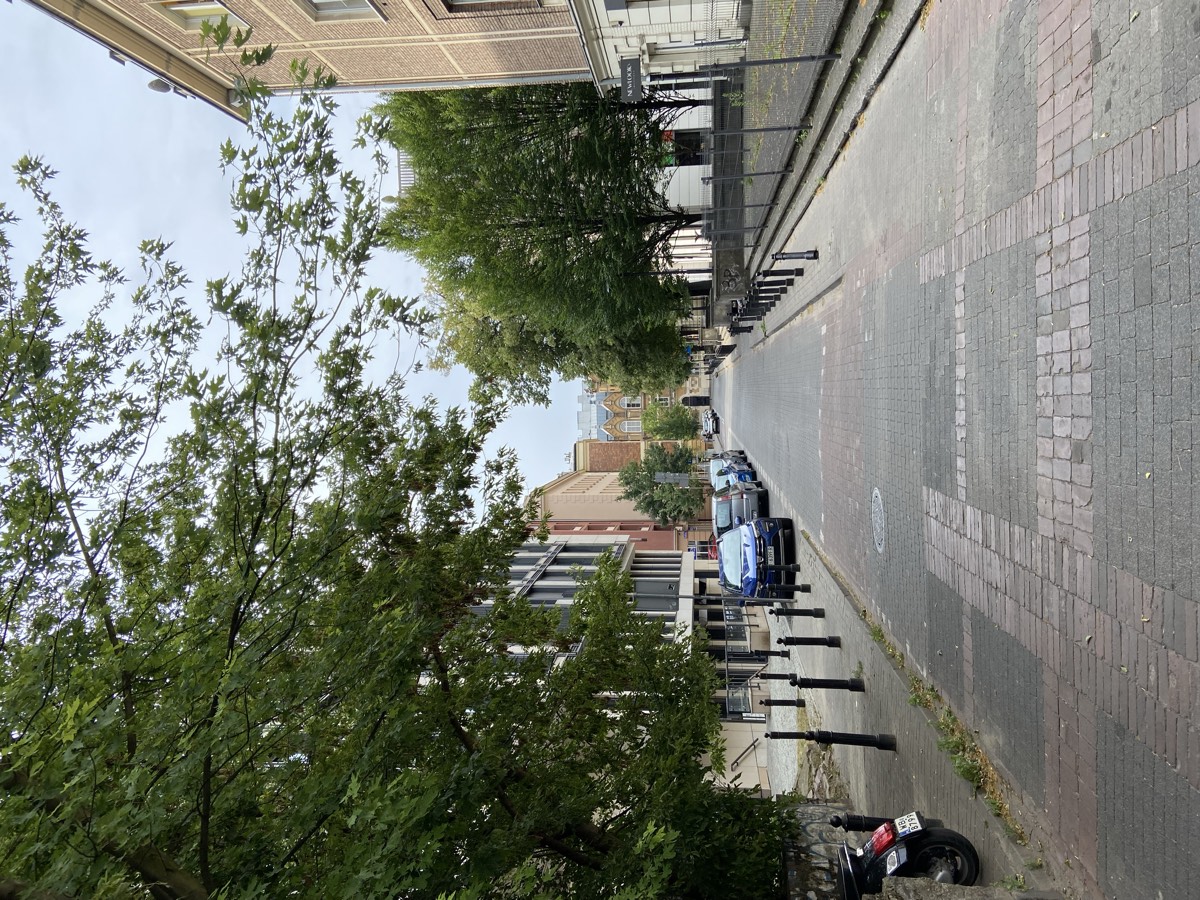
A street photo submitted to Locator for geolocation
Ul. Konstantego Ildefonsa Gałczyńskiego, Śródmieście district, Warsaw, Poland High confidence

Two independent clues converge. (1) The black shop sign on the right reads “NEWLOOK’S”; web search identifies NEWLOOK’s Institute, a cosmetology salon, at ul. Gałczyńskiego 5, 00-362 Warszawa, Śródmieście (just off Nowy Świat). (2) The parked moped’s plate reads “WB 8799” — a Polish EU plate with the “WB” Warsaw city registration prefix, consistent with all other blue-band plates in frame. Municipal records confirm ul. K.I. Gałczyńskiego is a short street running from ul. Foksal to Ordynacka in Śródmieście Północne, a quiet block-paved back lane off Nowy Świat — matching the photo (grey block-paver roadway, ball-topped cast-iron bollards, converted tenement fronts, mature lime trees, gentle downhill slope on the Warsaw escarpment). The neo-Renaissance twin-gabled mustard/ochre building with a modern grey rooftop addition closing the vista is consistent with the buildings terminating this street. The conclusion rests on the signage plus the plate.

How it works

01

Upload a photo

Upload a photo or paste an image URL and pick how deep the agent should go: Quick, Standard or Deep. For Standard and Deep, you can also add context and tell it where to look.

02

It builds a case

The agent cross-references architecture, vegetation, signage, and terrain — reasoning step by step like an analyst.

03

Get your report

Standard and Deep investigations produce a written report with evidence and ranked candidates — shareable by link or exported as a PDF.

More than one answer

Locator goes deep on the most likely location. The other candidates are the alternatives it seriously weighed along the way — not a broad survey of every possible place.

Ranked candidates

Standard investigations list up to 3 candidate locations in total, best first; Deep lists up to 5. Each has its own confidence — High, Medium or Low — a one-line reason, and an open-in-Google-Maps link.

Ruled out

Deep investigations also list the places they checked and excluded, each with the reason — for example, “Tram tracks and signage are Croatian.”

In the report and the PDF

Both lists appear on the report page and in the PDF export. If an investigation runs out of time before concluding, its report still shows the leads it had found.

Tell it where to look

For Standard and Deep investigations, you can narrow the search — and still add free-text context alongside, like “taken near a river.” Quick stays a fast one-look estimate without them.

Lock to countries

Limit the search to up to 10 countries.

Draw an area

Pick a centre point on a map and a radius from 1 to 1,000 km. In Deep mode, Street View checks stay inside the area you drew.

A firm limit, honestly applied

The agent searches inside your area. If the evidence clearly contradicts it — say the signage is from a different country — it says so plainly and lowers its confidence instead of giving a confidently wrong answer. The report shows the area that was searched.

Confidence, stated plainly

Locator won't guess without evidence — it tells you exactly how sure it is.

High confidence

Multiple independent cues agree — the agent is confident in the location.

Low confidence

Some evidence points somewhere, but it's thin — treat this as a lead, not a verdict.

Inconclusive

Not enough to go on. The agent would rather say nothing than guess.

Try it on your next photo

Every plan starts with a 1-month free trial.

Start free trial See pricing